
ISS Night Photo and Google Earth
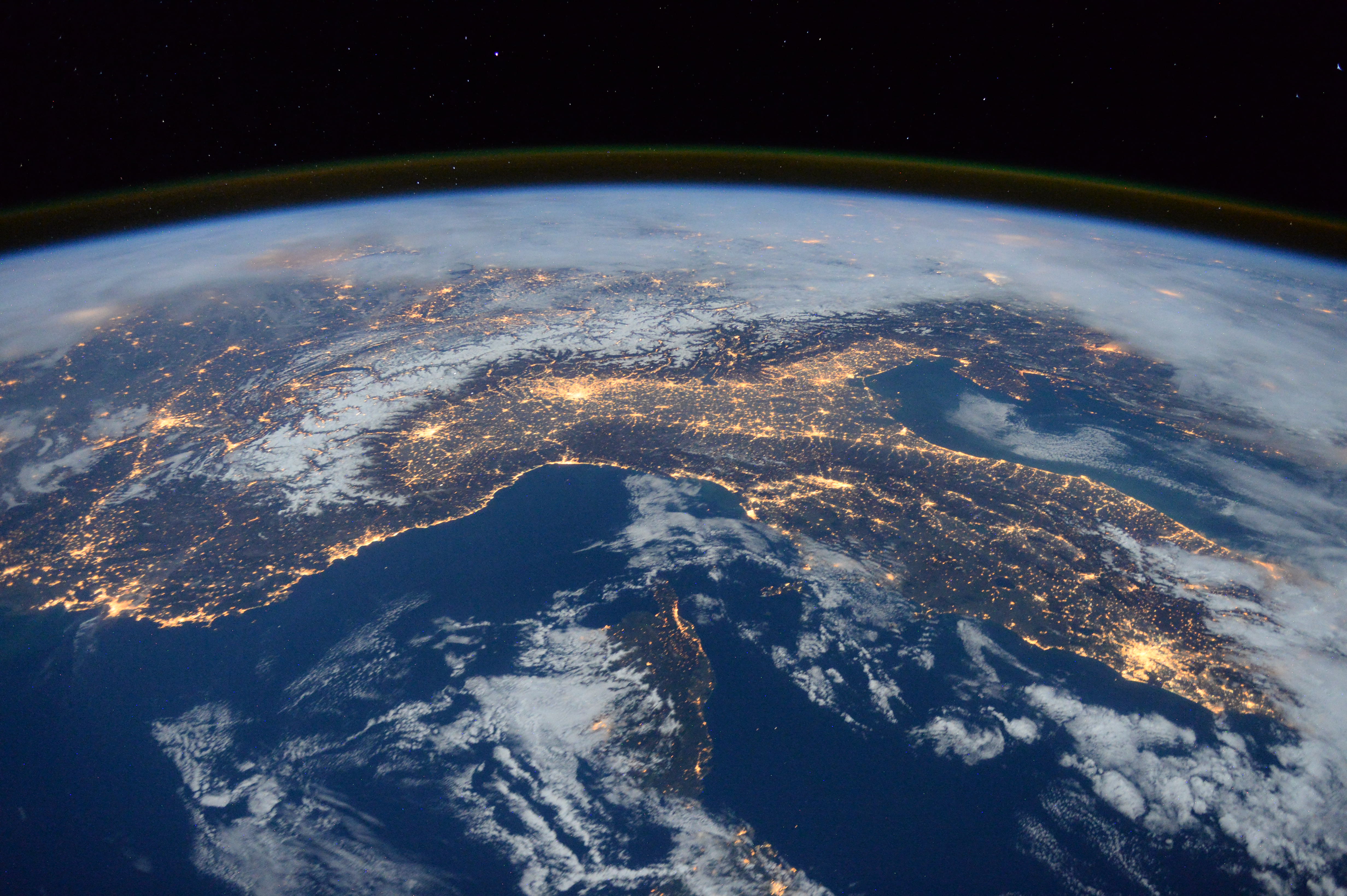
A couple of weeks ago, flight engineer Tim Peake of the European Space Agency tweeted this awesome picture of parts of southern Europe and the Mediterranean.
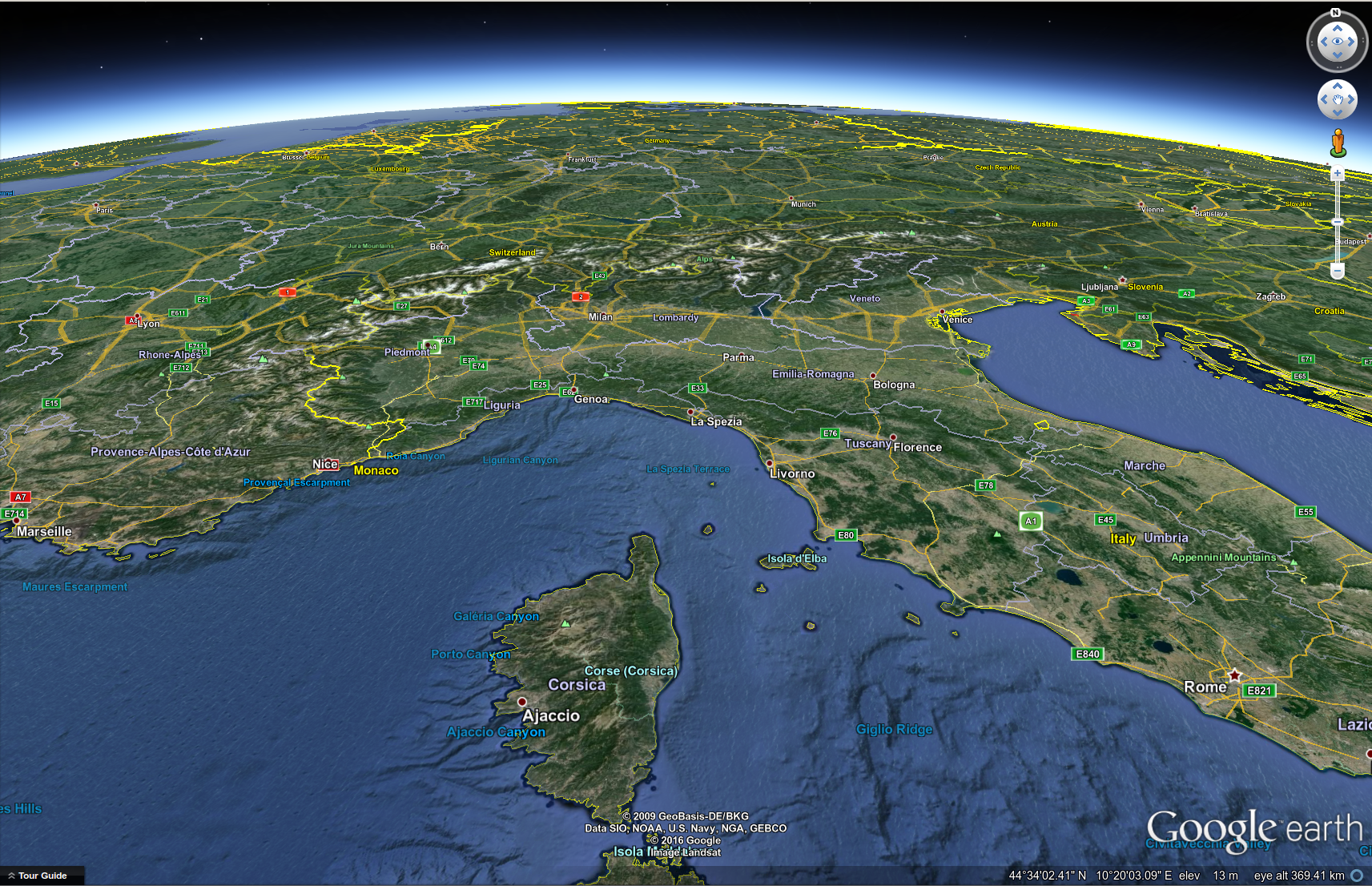
Out of curiousity, I opened up Google Earth and was able to match up where (roughly) the shot was taken from.
Now you can see that the large, lit up area near the bottom, right is Rome. Near the center of the image is Milan at the northern edge of Italy. You can see the island of Corsica half-covered by clouds in the lower, center of the image. Off to the left, you can see the French cities of Marseilles on the coast, and the city of Lyon almost directly up from Marseilles. Off to the right, you can also see the Croatian capital, Zagreb, as well as the capital of Slovenia, Ljubljana. Oh, and that big glow (covered in clouds) in the upper, lefthand corner is none other than Paris!.
I've created a Google Earth placemark with roughly the same location and angle as the original night shot. I even tried to match the ISS's altitude of roughly 400 km.
Thanks, Tim. That was pretty cool!